Smoke Streams From Wildfires Raging in Madeira


Heat and wind gusts helped the blazes spread through over 5,700 hectares of forest.
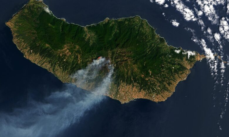
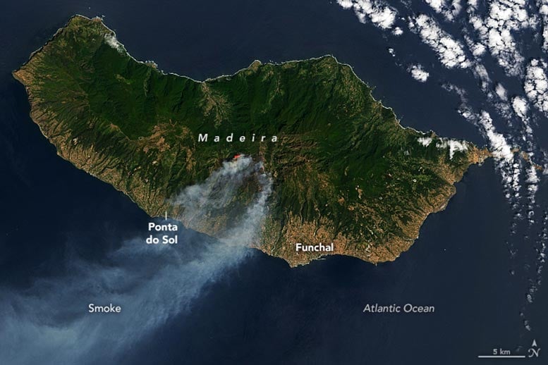
In mid-August 2024, fires raged on Madeira, a Portuguese island 700 kilometers (430 miles) west of Morocco. As of August 20, the flames had burned more than 5,700 hectares of forest, according to the European Forest Fire Information System.
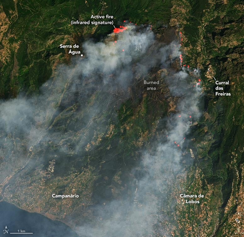
The blaze, which started in the mountains of Serra de Água on August 14, quickly spread east toward Curral das Freiras and Câmara de Lobos. When the OLI (Operational Land Imager) on Landsat 8 acquired these images on August 17, the fire was burning on three active fronts, and smoke streamed from the southern coast of the island over the Atlantic Ocean. The natural-color scenes are overlaid with an infrared signal to help distinguish the heat signature of active fires.

Heat and high winds helped the fire spread in the forested mountains of the island. In the days after the fire started, local reporting indicated wind gusts up to 70 kilometers (43 miles) per hour and temperatures hovering around 30 degrees Celsius (86 degrees Fahrenheit). After August 17, the fire fronts expanded west and north of Serra de Água. On August 18, more than 160 people were evacuated from their homes, local authorities said, as firefighters attempted to tackle the blazes in difficult-to-access hilly terrain.
The European Forest Fire Information System, which uses data from the MODIS (Moderate Resolution Imaging Spectroradiometer) sensors on NASA’s Terra and Aqua satellites, estimated that much of the 5,700 hectares of burned area was woodland, shrubland, and broadleaf forest. As of August 20, blazes were close to residential parts of Curral das Freiras, although the fires had not damaged any property.
NASA Earth Observatory images by Lauren Dauphin, using Landsat data from the U.S. Geological Survey.
Source link


