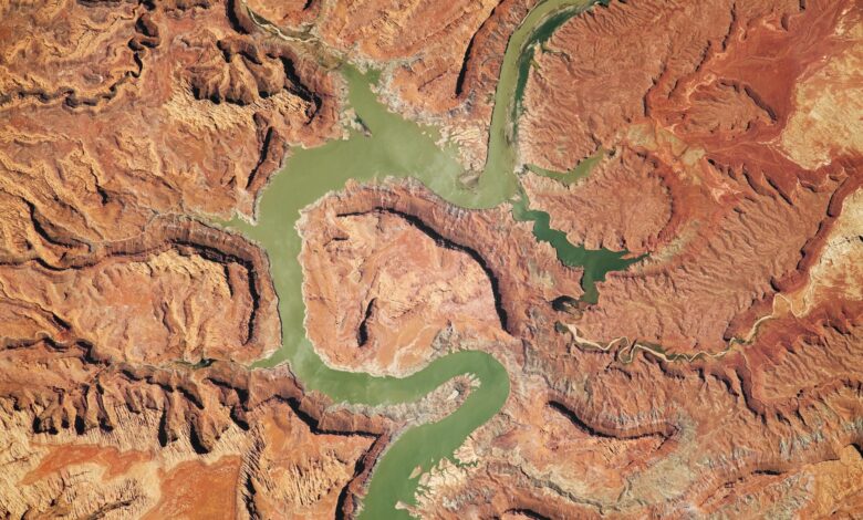
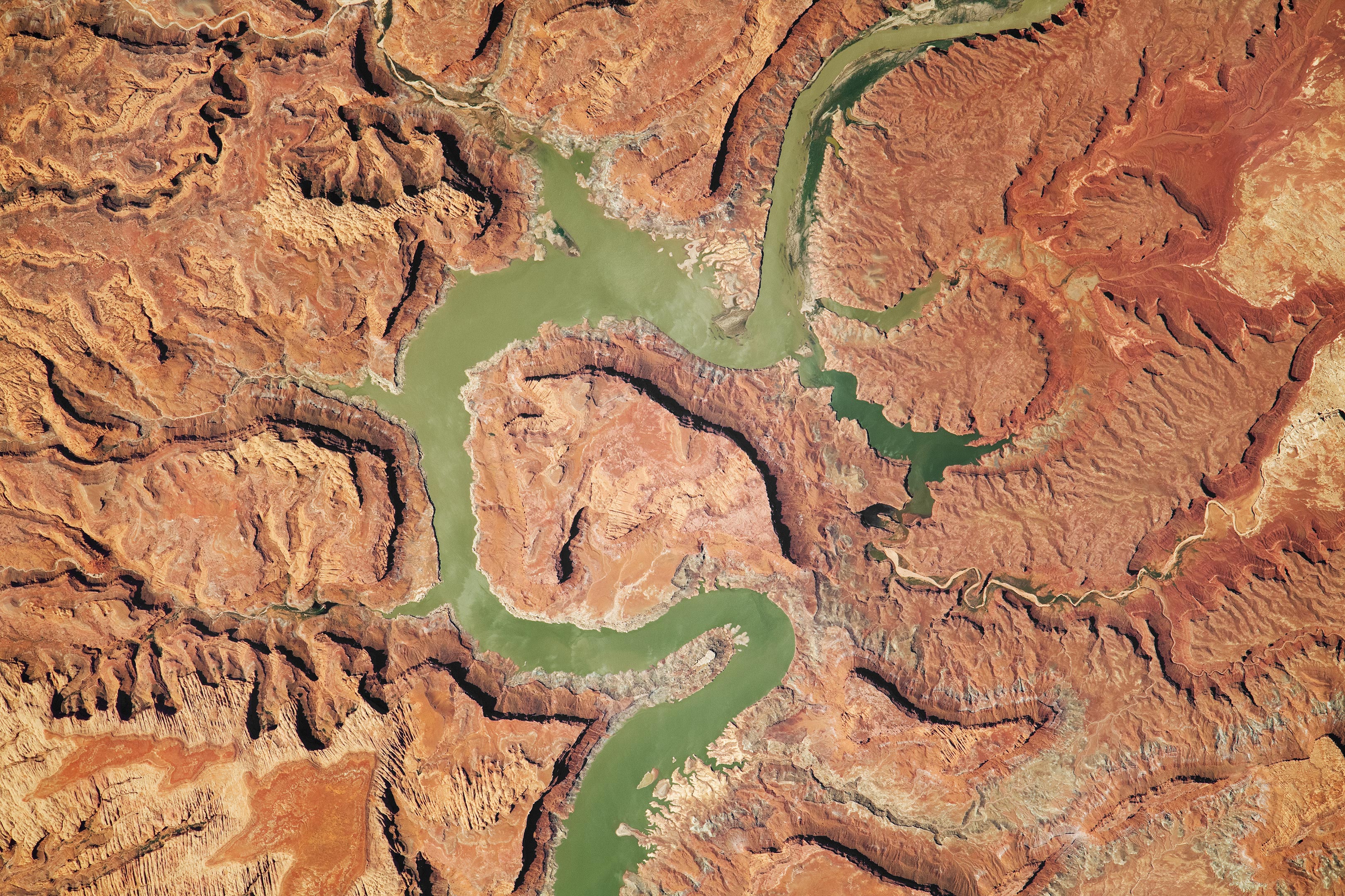
Photograph of the the Upper Lake Powell region in Utah captured on July 28, 2023, by an astronaut aboard the International Space Station.
Erosion, tectonic uplift, and a human-built dam have all helped shape the Upper Lake Powell area in Utah.
In the high desert plateau of southeastern Utah, the Colorado River and its tributaries cut across the landscape and carve numerous canyons. While orbiting over Utah, an astronaut aboard the International Space Station (ISS) captured this photograph of the Upper Lake Powell region.
Lake Powell’s Formation and Features
The damming of the Colorado River in the 1960s created Lake Powell and contributed to the region’s current appearance. An outline visible along the water’s edges, known as a “bathtub ring,” indicates fluctuating water levels in the reservoir. The canyon walls cast deep shadows, adding depth to the image. Mudstone and Navajo sandstone paint the region in rusty red hues.
Geological Highlights and Erosion
Located within Glen Canyon National Recreation Area, this portion of the Colorado River lies downstream from Canyonlands National Park (northeast of this scene). In this image, several tributaries feed the Colorado River system, notably the Farley and White Canyon creeks. The Horn—the tall feature in the center of the photo—towers approximately 1,300 feet (400 meters) above the Colorado River. The elevation difference is due to erosion from the Colorado River, which carved a deep valley into the underlying plateau, creating an incised meander. Incision is a geological process in which river channels cut into bedrock that has been raised by tectonic uplift, thus forming deep canyon systems.
Notable Erosion Features
Erosion of sandstone by creeks surrounding Lake Powell also formed the Twomile and Fourmile canyons. Elsewhere along the Colorado River, erosion has shaped well-known features such as Horseshoe Bend, The Loop, and Bowknot Bend. Astronauts photographed Bowknot Bend in 2014.
Astronaut photograph ISS069-E-39063 was acquired on July 28, 2023, with a Nikon D5 digital camera using a focal length of 1,150 millimeters. It is provided by the ISS Crew Earth Observations Facility and the Earth Science and Remote Sensing Unit, Johnson Space Center. The image was taken by a member of the Expedition 69 crew. The image has been cropped and enhanced to improve contrast, and lens artifacts have been removed. The International Space Station Program supports the laboratory as part of the ISS National Lab to help astronauts take pictures of Earth that will be of the greatest value to scientists and the public, and to make those images freely available on the Internet.